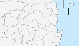
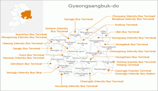
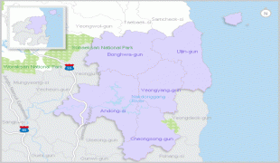
Gyeongsangbuk-do
 |
 |
Daegu was the capital of North Gyeongsang Province between 1896 and 1981, but has not been a part of the province since 1981. In 2016, the provincial capital moved from Daegu to Andong.
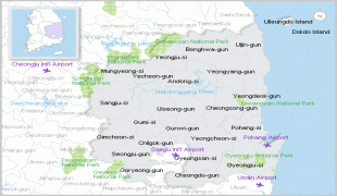
The area of the province is 19030 km2, 19.1 percent of the total area of South Korea.
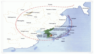
The province is part of the Yeongnam region, on the south by Gyeongsangnam-do, on the west by Jeollabuk-do and Chungcheongbuk-do Provinces, and on the north by Gangwon-do Province. During the summer, North Gyeongsang Province is perhaps the hottest province in South Korea. This is helped by the fact that the province is largely surrounded by mountains: the Taebaek Mountains in the east and the Sobaek Mountains in the west.
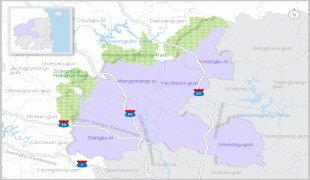
Map - Gyeongsangbuk-do
Map


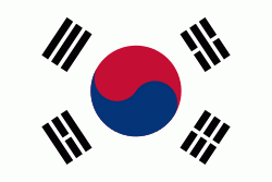
Country - South_Korea
 |
 |
| Flag of South Korea | |
The Korean Peninsula was inhabited as early as the Lower Paleolithic period. Its first kingdom was noted in Chinese records in the early 7th century BCE. Following the unification of the Three Kingdoms of Korea into Silla and Balhae in the late 7th century, Korea was ruled by the Goryeo dynasty (918–1392) and the Joseon dynasty (1392–1897). The succeeding Korean Empire (1897–1910) was annexed in 1910 into the Empire of Japan. Japanese rule ended following Japan's surrender in World War II, after which Korea was divided into two zones; a northern zone occupied by the Soviet Union and a southern zone occupied by the United States. After negotiations on reunification failed, the southern zone became the Republic of Korea in August 1948 while the northern zone became the communist Democratic People's Republic of Korea the following month.
Currency / Language
| ISO | Currency | Symbol | Significant figures |
|---|---|---|---|
| KRW | South Korean won | â‚© | 0 |
| ISO | Language |
|---|---|
| EN | English language |
| KO | Korean language |


